 Fort Munro was developed by Sir Robert Sandeman in 1869 and named after Capt. Munro, the then Commissioner Derajat Division.
Unique Features
- 6,470 ft (height above sea level)
- Climate is cool & pleasant in summer whereas, extremely cold and harsh in winter
- Average rainfall is 10.70 inches per annum
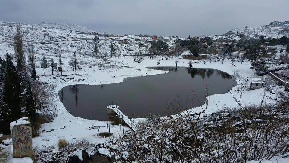
 Geography and Climate
Fort Munro is part of the Sulaiman Mountain range. The range is located in central Pakistan, extending southward about 280 miles (450 km) from the Gumal Pass to just north of Jacobabad, separating the khyber pakhtunkhwa and Punjab from Balochistan. Its heights gradually decrease toward the south, with summits averaging 6,000–7,000 ft, the highest being the twin peaks (30 miles from the Gumal Pass) called Takht-i Sulaiman, or Solomon's Throne, which legend connects with King Solomon's visit to Pakistan, the peak at 18,481 ft (5,633 m), is the site of a Muslim Ziyarat (shrine) visited annually by many pilgrims. The range's eastern face dips steeply to the Indus River, but on the west the range declines more gradually. Juniper and edible pines abound in the north and olives in the centre, but vegetation is scarce in the south. The Ghat, Zao, Chuhar Khel Dhana, and Sakhi Sarwar are the principal passes in the north. In the south, west of Dera Ghazi Khan, lies the hill station of Fort Munro.